Aerial of area
Original Filename: Racecourse_Option_One_overlay.jpg (view)
Original Size: 186.2 KB
Original Image Type: image/pjpeg

Caption
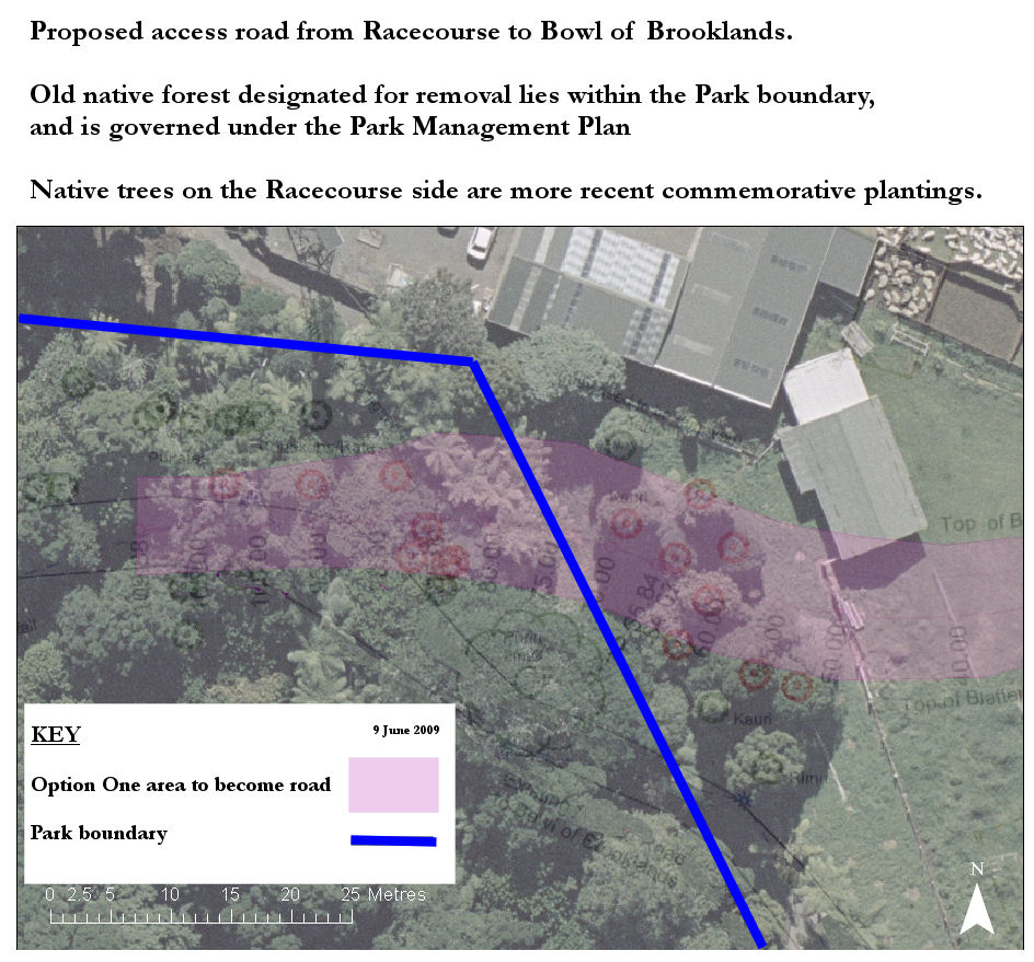
This aerial photo shows is overlaid by a plan showing the trees to be removed, and the Park boundary.
The trees to the east of the boundary were planted here from the 1970s onwards, as a windbreak, and also with commemorative trees.
The mature forest to the west of the boundary lies within the Park, and is subject to the Park Management Plan.
